blah blah blah
Little and Big Sugarloaf
Length: 3.4 miles out-and-back with loopDifficulty (click for info): Easy
Elevation Gain: 1130 feet
Rating (click for info): 5/10
Elevation: 995' (Little) and 1373' (Big)
Prominence: 114' (Little) and 302' (Big)
Driving Directions:
Parking area and trailhead are on West Shore Road in Alexandria, NH. West Shore Road leaves the north side of Rt. 3A 2.1 miles north of Rt. 104. The parking area is on the left side of the road, 2.9 miles from Rt. 3A. Click here for a Google map.
About the Hike:
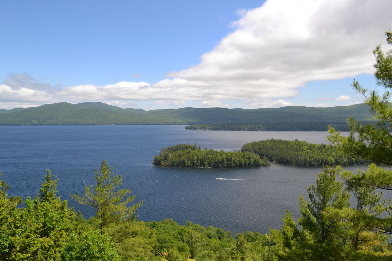
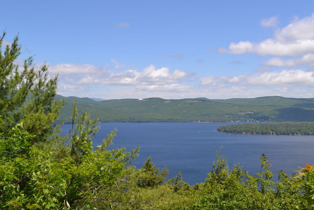
The two "Sugarloafs" near Newfound Lake are certainly not unique in New Hampshire mountain naming conventions, but they do continue in the fine tradition of Sugarloaf Mountains being highly regarded hiking destinations with rewarding views. In this case, Little and Big Sugarloaf Mountains each offer the vista seeker a nice perspective over the state's least esteemed vacation waterbody, Newfound Lake. They Form the end of an extended ridge which begins with them and wraps around to the north, west, then south, and culminates in the highest point in the area, Mt. Cardigan. This grouping of mountains walls off Newfound Lake on the west side, forming the vertiginous plummet down to the rockfall beside West Shore Road, which can unnerve first-time visitors to the area. As this road presents a lovely view across the waters to the hill country all around, the boost in altitude by climbing to the tops of the Sugarloafs summons a yet grander view. Neither summit is more than 1/3 mile away from the water's edge as the crow flies, and Big Sugarloaf towers nearly 800 feet over the lake, illustrating how this little mountain rises above its league in terms of scenery. The bird's-eye lake view from both Sugarloaf summits is well worth the effort. Both peaks' viewpoints face the same direction; Big Sugarloaf's is slightly wider and higher. The climb to Little Sugarloaf is short and easy, while continuing to Big Sugarloaf requires a bit more effort.
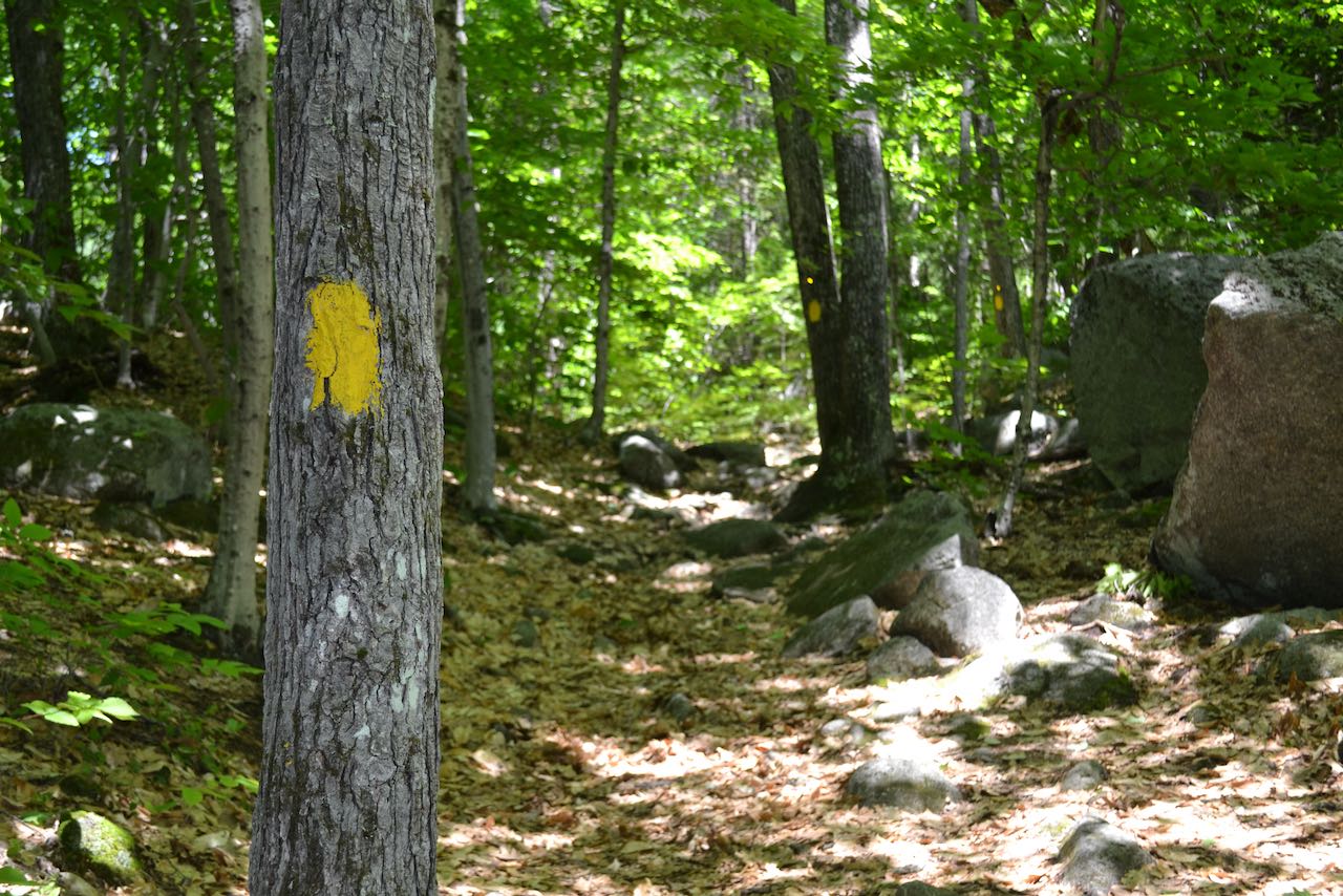
From the parking area, walk up to the Elwell Trail sign and bear left onto Elwell Trail. You can also bear right onto the Goose Pond Snowmobile Trail; both routes rejoin in 0.3 miles. The trail then begins to rise gradually through the woods, passing several boulders. Steepening as it approaches the top, in half a mile the trail reaches the ledgy but wooded summit of Little Sugarloaf. Bear right and walk down to the viewpoint ledge, where you have a good view over the lake. An advantage of the lower elevation of this summit is that you can observe the lake shore in greater detail, taking in the many lakehouses and coves. The major hills on the other shore from your perspective are Plymouth Mountain on the left and Peaked Hill on the right.
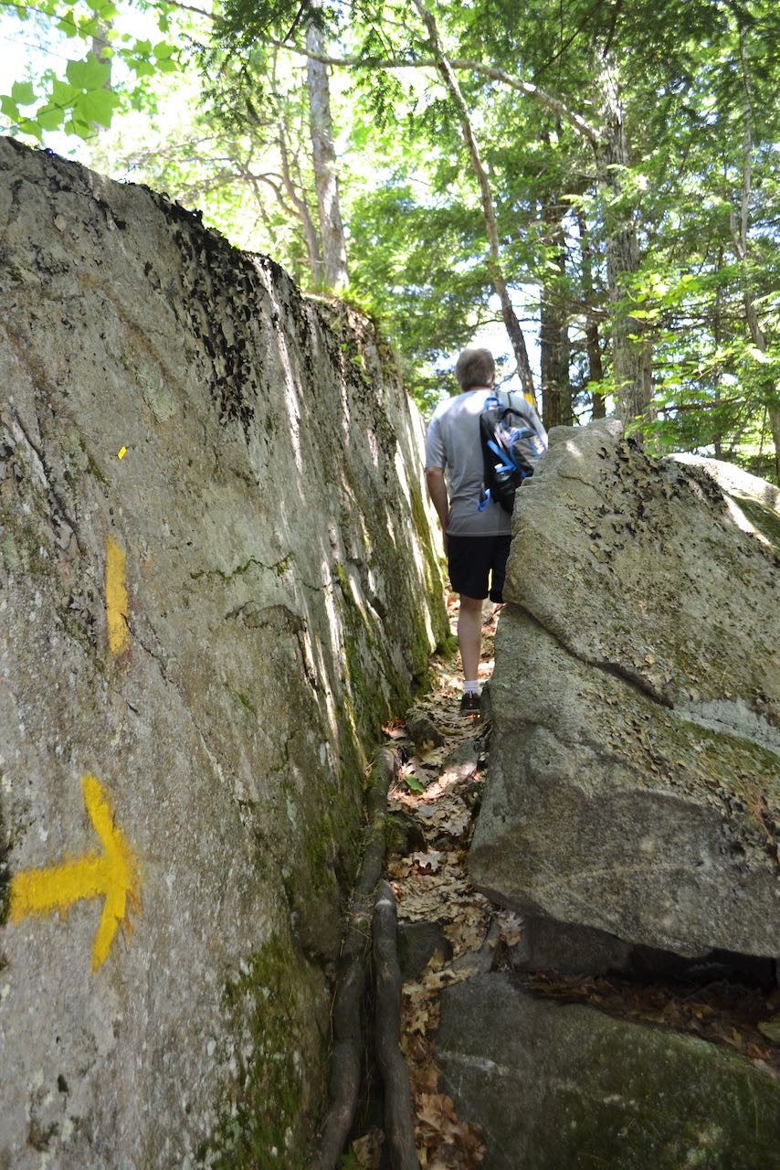
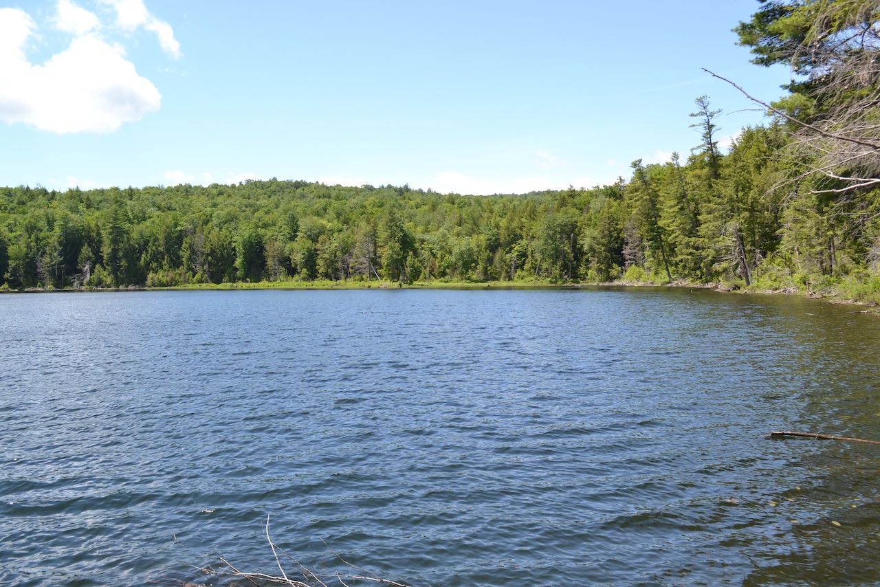
Follow the yellow blazes across the rocky top, and make your way down the other side of the sharp summit cone, reaching a low point after about 0.1 miles. The trail then climbs through an interesting rock passageway on its way over an intermediate hump, passing both ends of a cutoff trail on the left. After rising to the minor high point, it descends to a junction with Goose Pond Trail in another 0.15 miles. On your return trip, you can follow this trail to visit Goose Pond, and avoid Little Sugarloaf without adding any extra distance. Or, for an abridged adventure, turn here and make your way back now. Not far after this, the trail passes a boulder signed "Garden of Gethsemane". The imaginative connection to the Biblical landmark is unclear. In 0.1 miles the trail passes one end of "Rest Area Loop" (this optional detour is 0.2 miles long and goes through a forested ledge area), and takes another 0.1 miles to reach the other end. The trail then ascends the steep cone of Big Sugarloaf in earnest, reaching the summit in 0.35 miles. The ascent is through mostly open forest, and skirts a few open ledges just off trail on the right side near the top. Take a few steps over to these ledges for a bonus viewpoint which takes in the hills to the south, including Hersey Mountain, as well as the ski slope side of Ragged Mountain. The trail passes White Trail on the left, then meanders across the ledgy summit of Big Sugarloaf for 0.1 miles to the viewpoint. Here, there is another good view of Newfound Lake, slightly different than Little Sugarloaf's. Tree growth obscures the view directly downward to the lake that Little Sugarloaf had, but the extra elevation opens up the view to some distant peaks that could not be seen earlier. Across the south end of the lake, Belknap Mountain can be seen, and all the way to the left through the trees, some of the White Mountains in the Osceola-Tecumseh region can be glimpsed. A careful observer who knows his mountains may spot the eastern end of the Sandwich Range, including Mt. Chocorua, over the hills straight across the lake. On your way back, take a no-cost loop to bypass Little Sugarloaf and take a peek at Goose Pond. At the base of Big Sugarloaf, bear right onto the aforementioned Goose Pond Trail and follow it down at mellow grades for 0.4 miles to the pond. The trail joins a loop around the pond (an option to extend your hike), and follow the shore of the quiet place for 0.1 miles. Bear left off the loop and continue another 0.1 miles to rejoin Elwell Trail, 0.35 miles from the parking area.
Printable directions page